Columbia Valley AVA
Bold. Expansive. Surprising. Just 60 miles east of Portland, the Columbia Gorge AVA lies in the heart of the dramatic river corridor that straddles the Columbia River along the borders of Oregon and Washington.
Key statistics
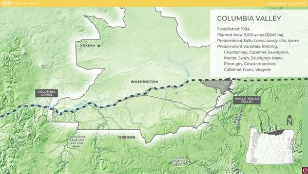
1984
9,010 acres
Loess, sandy silts, loams

Characteristics
About the region
Just 60 miles east of Portland, the Columbia Gorge AVA lies in the heart of the dramatic river corridor that straddles the Columbia River along the borders of Oregon and Washington.
The climate in the Columbia Gorge AVA is categorized as transitional. The western end of the Columbia Gorge, close to the Cascade Mountains, has a cooler, marine-influenced climate where it rains 36 inches per year. Stretching 40 miles eastward, the climate transitions to continental high desert with just 10 inches of annual rainfall. Throughout the Gorge, elevations of vineyard sites range from sea level to 2,000 feet, which greatly impacts temperatures during the growing season.
The Columbia River Gorge is the only sea-level passage through the Cascade Mountain Range, funneling persistent winds at an average speed of 10-20 miles per hour (16-32 kph) or more, acting as a cooling and drying force to the vineyards.
This extreme variance of climate means the Columbia Gorge AVA can successfully grow a wide range of classical varieties. Wines produced from this region tend to be riper than wines from Oregon’s cooler, western regions with higher acidity and structure than what occurs naturally in the warmer, eastern AVAs.

